


Let me start with special thanks to our live participants today, Diane Burley, Dr. Mary M. MarshallLori Olson White, Kyla Bayang, Nancy Feagans, Richard Hogan, MD, PhD(2), DBA and many others. I can appreciate how hard it is to change your routine on a Saturday to join us for this kind of program.
Remember, if you enjoy or find this recording useful, you’d be doing us a favor to drop a little ❤️ and add your thoughts in the comments below. If you think it’ll be valuable to others, share it individually or in group pages. We always welcome fellow travelers on the path of family history. Everyone is invited to subscribe.

Today’s program was the third of our eight programs celebrating stories About That Place that runs through October 3rd. The series, shared under #AATP25, has been organized by the Society of Genealogists in collaboration with the Society for One-Place Studies, the British Association for Local History (BALH), and Genealogy Stories. It’s an honor to be part of this program again.

Today’s wide-ranging conversation explored a wide range of maps and their applications to family history and one-place study projects. Among the many insights were:
How to use maps to determine how ancestors might have traveled and how long it might have taken.
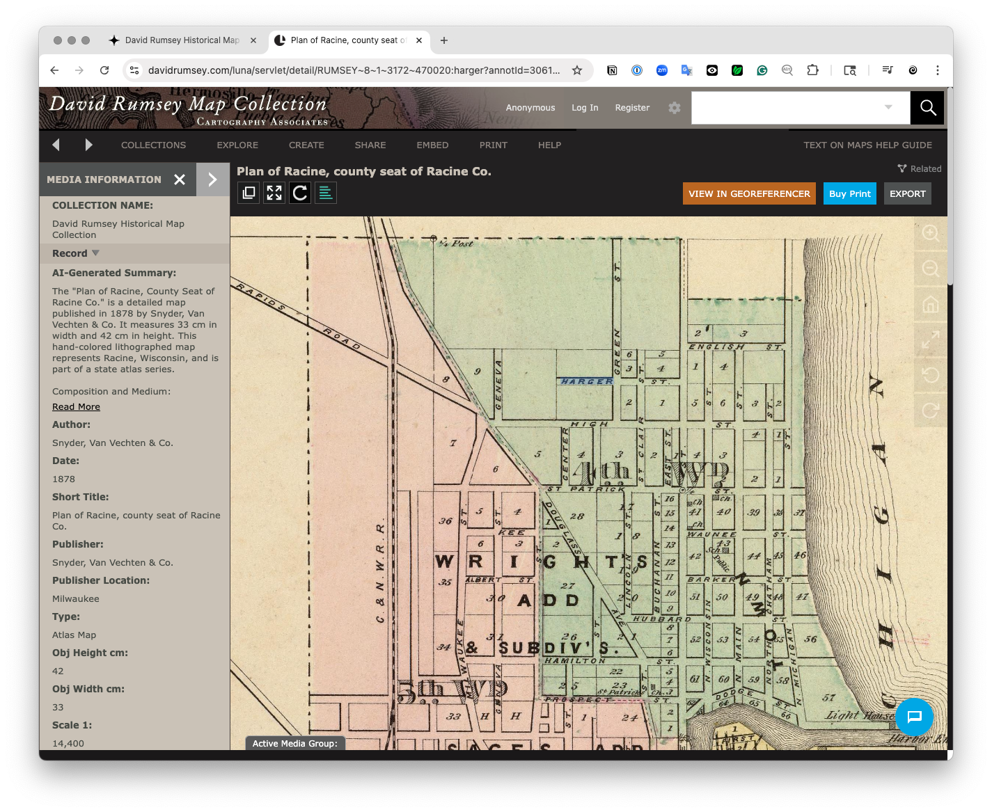
How to overlay historical maps onto modern maps. Annette referenced the extraordinary David Rumsey collection, particularly its GeoReferencer overlay feature. While pulling that link up, I discovered a new “Text on Maps” feature as well. (The AI must have heard Annette. 😉)
Annette also mentioned a site that calculates travel in historical times by foot, horse or carriage. (Watch for the site name in an update or comment).
In the original talk she gave last year, Annette included a detailed PDF handout she generally shares with formal presentations she does about the maps at the Library of Congress. You won’t want to miss that.

I hope you found this a fun exploration of Annette's talk last year and sources for research materials. You’ll find that original recording here:

Please join us tomorrow for our conversation with Anne Young of Anne’s Family History. Learn more:

Note: These programs are using Substack for livestreaming. You won’t need to register, but you will need to be logged in with a Substack account. As a follower or subscriber you’ll be notified when the live program begins.
With the kind support of our Patrons, all Projectkin programs are offered free. These recordings will be posted to a special playlist on Projectkin’s YouTube channel, and as part of AATP25, they will also be cross-posted to the Facebook-based All About That Place group.


